Oeschinen Lake Hike Switzerland – Best Viewpoints & Social Media Spots

Facebook
WhatsApp
Pinterest
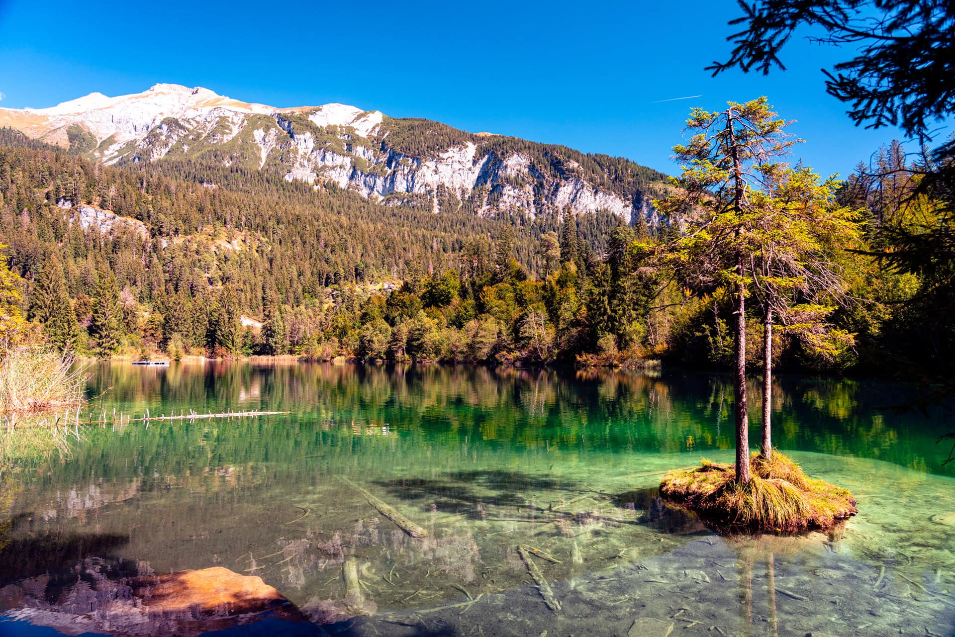
Panoramic view of Oeschinen Lake with turquoise water and steep cliffs of the Bernese Alps in the background
The Oeschinen Lake hike is one of the most breathtaking hikes in Switzerland. High above the turquoise lake, the trail leads along steep cliffs, through alpine landscapes, and to some of the most iconic viewpoints in the Bernese Oberland. Along the way, you’ll constantly discover new perspectives of Oeschinen Lake while moving from one photo spot to the next. From the famous two trees to a hidden bench overlooking the lake, every section of this hike offers another highlight. Ready for one of the most scenic panoramic hikes in Switzerland?

ℹ️ Click on the + to view the trail info.

🥾 Trail Info 🔽
  • 📍 Start and End: The Oeschinen Lake hike typically starts at the Oeschinen Lake cable car mountain station or directly in the village of Kandersteg if you choose to hike up. The route ends back in Kandersteg, with the option to take the cable car down. You can check the latest operating hours of the Oeschinen Lake cable car on the official website.
  • 🚶‍♂️ Distance: The hike covers around 12 km (7.5 miles) round trip back to Kandersteg. Taking the cable car can shorten the distance by about 3 km (1.9 miles). Depending on the route you choose, the total distance may vary slightly.
  • ⏱️ Duration: The pure hiking time for the Oeschinen Lake hike is حوالي 4 hours. However, it’s recommended to plan a full day. If you want to spend time at the famous viewpoints and photo spots, you should allow around 5 to 6 hours.
  • 📊 Elevation Gain and Loss: The ascent is 513 meters (1,683 ft), while the descent is 1,030 meters (3,379 ft).
  • 🥵 Difficulty: This hike is rated T2 (moderate). The initial ascent can be challenging, and the long descent also requires endurance. A good basic level of fitness is recommended.
  • 📆 Best Season: The hike is best from summer to early autumn. In winter, parts of the trail are closed. During summer, the lake shows its most intense turquoise color. You’ll find more inspiring routes in my panoramic hikes in Switzerland.
  • 🥾 Equipment: Ankle-high hiking boots are recommended. Since much of the trail is above the tree line, make sure to bring sun protection and enough water. Hiking poles can be helpful, especially on the descent.
  • 🌿 Terrain: About 4 km (2.5 miles) of mountain trails, 6 km (3.7 miles) of regular hiking paths, and short sections along 3 km (1.9 miles) of minor roads. Overall, the route is varied and easy to follow.
  • 👨‍👩‍👧 Family-Friendly: The hike is not suitable for strollers. It is doable for children, but they should have a good level of fitness. The long descent in particular can be tiring.
  • 🐕 Hiking with Dogs: Generally doable, but parts of the trail are narrow and run along steep slopes. Your dog should be sure-footed and remain under control, and a leash is required. Bring enough water, as there are only a few natural sources along the route.
  • 🚗 Getting There: The hike is easily accessible by both car and public transport. There are parking spaces at the cable car station in Kandersteg, but they can fill up quickly in summer. If you arrive by public transport, the cable car station is within easy walking distance.
  • 💰 Costs: The hike itself is free. Parking at the cable car station in Kandersteg costs around CHF 12 for approximately 6 hours. A one-way ticket for the Oeschinen Lake cable car is about CHF 14.10 with a Half Fare Card or Swiss Travel Pass. It’s recommended to reserve your cable car ticket online in advance.
  • 📌 Signposts & Markings: At the beginning, follow the signs toward Oberbärgli instead of heading directly down to the lake. From there, the trail is well marked and easy to follow.
  • 📶 Mobile Reception: Signal is limited and varies along the route. In some sections, you may only get an SOS signal. It’s recommended to download the map offline in advance.
  • 📸 Best Photo Spots: Throughout the hike, you’ll constantly get stunning views of Oeschinen Lake. The most famous spots include the iconic two trees overlooking the lake and the popular bench below the trail, which is often featured on social media.
  • 🦌 Wildlife: The area is rich in wildlife, and you’ll often hear marmots along the trail. With a bit of luck, you might also spot chamois. In addition, it’s common to see goats and cows grazing on the alpine pastures.
  • 🌄 Highlights: The constant views of Oeschinen Lake make this hike a top-tier panoramic experience, even on cloudy days, the scenery keeps changing and creating new moods. If you’re also looking for quieter and lesser-known hikes, it’s worth checking out my Gasterntal hike.
  • 💡 Tips: Starting in the afternoon is worth it, as the light is better for photos. During the day, the sun can be very bright and directly overhead. Also, keep an eye on the time, as the cable car does not run indefinitely.
  • 🏡 Accommodation & Restaurants: Kandersteg offers a good selection of hotels and restaurants. There are also places to eat by the lake and at Alp Oberbärgli. It’s recommended to bring some cash, as not all locations may accept cards.

The Oeschinen Lake panoramic hike starts for us right at the train station in Kandersteg, where we arrive around 12:00 PM. We’ve done this hike several times before and know from experience that the morning light can be quite harsh. That’s why we deliberately choose a midday start to make the most of the softer afternoon light.
From the station, we walk through the village of Kandersteg, which immediately impresses with its traditional Swiss chalets and the beautiful parish church. Before leaving the village, we stock up on enough supplies, especially more water than usual, as temperatures in summer can quickly reach around 30°C (86°F). It’s better to carry a bit extra, as this hike shouldn’t be underestimated.

Kandersteg village with the Kander river, church, and alpine landscape in the Bernese Oberland, Switzerland
Start in Kandersteg. From here, our panoramic hike towards Oeschinen Lake begins.

After about 15 minutes, we already reach the Oeschinen Lake cable car base station. On sunny days, you quickly notice how popular this hike has become, especially through social media. The parking spaces fill up fast, so it’s definitely worth reserving both your parking and cable car ticket online in advance.

The cable car ride is relaxed and already offers your first views of the Bernese Alps. Once at the top, the trail initially descends slightly, but it’s important not to head straight down to Oeschinen Lake. Instead, follow the path toward Heuberg and Oberbärgli, this is where the actual panoramic hike begins.

At the beginning, the trail leads across open meadows and through scattered forest sections. You can already notice the tree line here before the landscape gradually becomes more alpine and the actual mountain hike begins.

Mountain hiking trail above Kandersteg with views of green forests and the surrounding Alps
Ascent along the panoramic trail with views over the Kandersteg valley

Right from the first ascent, we encounter many tourists who underestimate this hike, often even wearing sneakers. We strongly recommend proper hiking boots, as safety should always come first in the mountains.
The first 2.5 km (1.6 miles) are steep and lead over gravel and typical mountain trails that wind up the slope in switchbacks. Passing rocky sections, we gradually make our way higher until, after about 50 minutes, we turn a corner and catch our first glimpse of Oeschinen Lake.
The view feels almost unreal, especially when clouds drift across the alpine landscape. These changing light conditions make the moment truly special and create an atmosphere you won’t forget anytime soon.

First view of Oeschinen Lake from the hiking trail with turquoise water and mountain panorama in the background
The moment when Oeschinen Lake first comes into view
Hiker on mountain trail overlooking Oeschinensee and alpine scenery in Switzerland
Panorama trail above Oeschinensee during the hike
Close-up of the turquoise water at Oeschinen Lake with small boats and trees framing the scene
The intense turquoise color of Oeschinen Lake is one of its most striking features

We continue hiking steadily uphill, but the initially steep section becomes noticeably more manageable over time. As we gain elevation, more and more views of Oeschinen Lake open up, with its color changing depending on the season. In late summer, it can even appear slightly greenish, while in summer it shines in an intense turquoise.

After about 1.5 hours, we reach several benches with a breathtaking view of Oeschinen Lake. We take the opportunity for a break, unpack our snacks, and enjoy the scenery somewhere between midday and afternoon.
From here, the trail continues with only a gentle incline, and the sun now sits perfectly to the side, creating ideal lighting conditions. This is exactly where it’s worth taking your time, as the changing light constantly reveals new perspectives.

The exact location of these viewpoints is known as Heuberg viewpoint. The spots are clearly visible along the trail and hard to miss. However, the hike should not be underestimated, as you’ve already covered around 500 meters (1,640 ft) of elevation gain by this point.

Bench along hiking trail with view over Oeschinensee and alpine mountains in Switzerland
Rest spot with panoramic view of Oeschinensee along the hike

After a relaxing break, the hike continues with only a gentle ascent. With every step, the view opens up more across the entire Oeschinen Lake until the full panorama unfolds. The trail repeatedly follows steep slopes and narrow sections, adding an extra sense of adventure to the hike.
The weather was perfect light clouds kept the temperatures comfortable while hiking. At the same time, it becomes very clear how important sun protection is, as large parts of the trail are exposed to direct sunlight. A cap and proper protection are highly recommended.

After just under 2 hours, we reach the famous spot with the two trees and arguably the most beautiful panoramic view of Oeschinen Lake. There were already a few people there, even a small photoshoot taking place. We waited a moment and used the opportunity to capture the landscape from different perspectives.
At the latest here, you understand why this place is so popular on social media, the combination of lake, mountains, and perspective feels almost unreal. According to the map, this point can be reached in around 1.2 hours, but our timing is intentionally more relaxed, including breaks and photo stops.

Famous viewpoint at Oeschinen Lake with two trees on a ridge and turquoise water with mountains in the background
The most iconic photo spot of the Oeschinen Lake panorama hike near Kandersteg

Shortly after, within about 15 minutes, a lot of clouds suddenly roll in. For a moment, we thought it was about to rain, as some of them turned quite dark, even though no storm was forecast. Sudden weather changes like this are not uncommon in the mountains. In the end, however, we were lucky and stayed dry throughout the entire hike.

After around 2.5 hours, we reach Alp Oberbärgli, offering one of the best views over the entire Oeschinen Lake. At the alpine pasture, we encounter freely roaming cows and small goats grazing peacefully across the meadows. A special highlight is the section with small wooden bridges, beneath which a wild mountain stream flows down toward the lake, moments like these make the hike even more diverse.
There is also a restaurant here where you can take a break and recharge before heading down in switchbacks toward the lake. As the weather remained uncertain, we decided to continue without taking a longer break.

Panoramic view of Oeschinen Lake during the descent with hiking trail, alpine huts and mountain landscape in the Bernese Oberland
Weite Aussicht über den Oeschinensee und die Alp auf dem Rückweg
Hiking trail at Alp Oberbärgli with a wooden bridge over a stream and alpine landscape in cloudy conditions
Crossing streams and wooden bridges on the Alp Oberbärgli trail
Domestic goat on a rocky hiking trail at Alp Oberbärgli in the Swiss Alps
A typical encounter with goats along the alpine hiking trail

From here, the Oeschinen Lake hike continues mostly straight ahead, now below the panoramic trail. Unfortunately, more and more clouds roll in, gradually covering the mountain range, and we remain unsure whether it might start raining.

We continue at a relaxed pace along the cliffside, with constant views of Oeschinen Lake. After around 6 km (3.7 miles) and about 3 hours, we reach what is probably the most famous bench on social media. This spot is hard to miss and is one of the most popular photo locations along the entire hike.

Especially on hot days and when there are many visitors, you may need to wait a moment to take a photo here. The well-known perspective, first capturing the bench and then the view of Oeschinen Lake — is what makes this spot so special.

Hiking trail at Oeschinen Lake with a hiker in cloudy weather and turquoise water in the background
Hiking along Oeschinen Lake with changing mountain weather conditions
Hiking trail at Oeschinen Lake with a wooden bench under a rock and a view over the turquoise lake
Ein ruhiger Aussichtspunkt mit Bank entlang der Panorama Wanderung

After that, the hike continues comfortably back toward Kandersteg. Since we started in the afternoon and it was already past 18:00 (6:00 PM), we deliberately chose to hike down instead of taking the cable car. After more than 4 hours on the trail and over 10 km (6.2 miles) in our legs, we slowly made our way back down into the valley.

On the way back, we pass another bench with an impressive view over Kandersteg and the surrounding Alps. Especially in early autumn, the atmosphere here is unique, as the larch trees turn golden and the river winds through the valley. You can find the exact location of this bench here.

The clouds suddenly cleared again, and during the descent we were even able to catch the last golden rays of sunlight. A perfect ending to this panoramic hike.

Hiking trail above Kandersteg at sunset with warm light on the mountains
Descent from Oeschinen Lake to Kandersteg with golden evening light
Bench along the hiking trail with views of Kandersteg and the Alps in the Bernese Oberland, Switzerland
Beautiful bench with views over Kandersteg and the Bernese Oberland
View of the village of Kandersteg with river, forests, and mountains during the descent from Oeschinen Lake
View over Kandersteg with forests and a wild river

After the sunset and just under 5 hours, we reach Kandersteg train station again, where our hike comes to an end. With over 20,000 steps in our legs, we can already feel a slight muscle soreness — but that’s all part of hikes like this.

Conclusion: The Oeschinen Lake panoramic hike is, without a doubt, one of the most beautiful hikes in Switzerland. The combination of the turquoise lake, the surrounding mountains, and the constantly changing perspectives makes this route truly unique. It’s no surprise that it ranks among the most popular hikes in the Bernese Oberland.

We recommend starting the hike in the afternoon, as the sun is in a much better position and creates softer, more pleasant lighting across the landscape. It’s best to allow enough time to fully enjoy the viewpoints and photo spots without rushing.

If you’re looking for more panoramic hikes in Switzerland, you’ll find plenty of inspiration for your next adventure on my blog.
Feel free to leave a comment or reach out if you have any questions.

Details and Elevation Profile

Frequently Asked Questions about the Oeschinen Lake Hike

ℹ️ Click on the question to view the answer.

The Oeschinen Lake panoramic hike is considered a moderate mountain hike. The first section is particularly steep, with an elevation gain of 513 meters (1,683 ft). The descent is around 1,030 meters (3,379 ft) and can be tough on the knees. With good fitness and proper hiking boots, the hike is very manageable.

The pure hiking time is around 4 hours. Including breaks, photo stops, and a more relaxed pace, we spent about 5 hours on the trail. It’s best to plan enough time to fully enjoy the viewpoints and photo spots.

The total distance is12 km (7.5 miles). Taking the cable car can shorten the hike by about 3 km (1.9 miles). Depending on the route and descent, the distance may vary slightly.

The hike starts either directly in Kandersteg at the train station or at the mountain station of the Oeschinen Lake cable car. For the panoramic route, follow the trail toward Heuberg and Oberbärgli instead of heading straight down to the lake. This section offers the most beautiful views.

No, the hike can also be done entirely on foot. However, we recommend taking the cable car up and hiking back down. This way, you save energy for the panoramic section.

The best time for the Oeschinen Lake panoramic hike is from summer to early autumn. In summer, the lake shows its intense turquoise color, while in early autumn the landscape impresses with additional warm tones. This route is not suitable in winter.

We recommend starting the hike around midday or in the early afternoon. In the morning, the sun is often directly in front of you, creating very harsh light. In the afternoon, the lighting is much softer and more pleasant, especially for photos.

The most famous spots include the two trees overlooking Oeschinen Lake and the popular bench along the trail. The Heuberg viewpoint also offers several perfect photo locations. Throughout the entire hike, you’ll constantly find new perspectives and photo opportunities.

For the hike, we recommend good hiking boots, plenty of water, and sun protection. Since large parts of the trail are exposed to the sun, a cap is highly recommended. Especially in summer, it’s better to bring more water than too little.

The panoramic hike is not suitable for strollers and is only recommended for children with a good level of fitness. Hiking with a dog is generally possible, but parts of the trail are narrow and run along steeper sections. Your dog should be sure-footed and under control at all times.

Markus Manfredi, Swiss photographer and founder of Swissaround, with camera above Lake Lucerne

About Markus Manfredi – Swissaround

Grüezi, I’m Markus Manfredi, the photographer, videographer, and author behind Swissaround.
I love discovering new places and capturing them through my camera and blog stories.
With over 5 million followers, Swissaround is one of the largest social media channels for Swiss landscapes and travel inspiration.
As a Swiss native, my mission is to bring people closer to the true beauty of my home country through real moments and personal experiences.
As the author of the Magical Switzerland Guide, I share hidden gems, hikes, and experiences that few people know about.
Join me on my journeys around the world on the Swissaround blog.

Leave a Comment

Your email address will not be published. Required fields are marked *

Share this post easily with just one click.

Maybe someone is planning this exact tour right now! 📲💬

Facebook
WhatsApp
Pinterest
X / Twitter
LinkedIn
Email
Panoramic view of Oeschinen Lake with turquoise water and steep cliffs of the Bernese Alps in the background
Bern

Oeschinen Lake Hike Switzerland – Best Viewpoints & Social Media Spots

The Oeschinen Lake hike is one of the most breathtaking hikes in Switzerland. High above the turquoise lake, the trail leads along steep cliffs, through alpine landscapes, and to some of the most iconic viewpoints in the Bernese Oberland. Along the way, you’ll constantly discover new perspectives of Oeschinen Lake while moving from one photo spot to the next. From the famous two trees to a hidden bench overlooking the lake, every section of this hike offers another highlight. Ready for one of the most scenic panoramic hikes in Switzerland?

READ MORE
Panoramic view of Gasterntal near Kandersteg in the Bernese Oberland with steep rock walls and river in summer
Bern

Gasterntal Hike in Kandersteg – Waterfalls & Scenic Trail in the Bernese Oberland

Above Kandersteg lies the lesser-known Gasterntal, accessible via the spectacular Chlusestrasse through a narrow rock gorge. Beyond the winding single-lane road, a wide alpine valley opens up, shaped by the wild Kander River, towering cliffs, and impressive waterfalls such as the Geltenbachfall. The landscape feels untouched and peaceful, far away from the busy tourist hotspots of the Bernese Oberland. Could this be one of the most impressive hikes near Kandersteg?

READ MORE
asserfallarena Batöni in the Weisstannental with multiple waterfalls and yellow alpine troll flowers on a summer meadow
Challenging hike

Waterfall Arena Batöni Hike – Five Stunning Waterfalls in Weisstannental, Switzerland

The Oeschinen Lake hike is one of the most breathtaking hikes in Switzerland. High above the turquoise lake, the trail leads along steep cliffs, through alpine landscapes, and to some of the most iconic viewpoints in the Bernese Oberland. Along the way, you’ll constantly discover new perspectives of Oeschinen Lake while moving from one photo spot to the next. From the famous two trees to a hidden bench overlooking the lake, every section of this hike offers another highlight. Ready for one of the most scenic panoramic hikes in Switzerland?

READ MORE
Scroll to Top
Official Swissaround logo featuring a hiker, pine trees, and a mountain silhouette

Places most people never see 👀

Discover my best hikes and hidden spots in Switzerland, delivered straight to your inbox.